0 Monorail Proposed in Boston

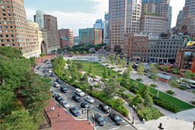
Aerial view of the greenway in downtown Boston

Credit: Boston Herald

We have worked so hard to suppress the central artery I’m not too sure it makes sense to litter it with a monorail.

From the Boston Herald:

Minnesota-based JPods has proposed bringing their solar-powered gondola pods to Boston and Somerville, an idea that caught the attention of former city councilor Steve Murphy, who liked them for the Greenway.

JPods are among a category of vehicle called personal rapid transit, a network of small, solar-powered automated vehicles that operate on specially built guideways. They’ve been tested — in different forms — everywhere from New Zealand to Abu Dhabi and even installed in Heathrow Airport to ferry travelers from Terminal 5 to the long-term car park. The expansion of these projects always seems to end with the conclusion that they don’t move a high enough volume of people for the considerable cost. It’s just the type of problem Boston’s innovators could take on.

0 Boston’s MBTA: Least Reliable Transit System in the U.S.

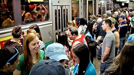
Boston commuters wait for the MBTA train

Credit: BBJ

Boston takes another 1st position in the nation, this is not a positive, however, this is The T!

Our beloved MBTA is dead last with the most breakdowns in the U.S. We are an educated Commonwealth, but we really need to get smart about how we expect our workforce to commute without operational issues beyond their control.

According to a recent article on the Boston Business Journal, “the MBTA recorded 219 major mechanical failures on its commuter rail lines in 2014 — four times the national average. (Notably, the data did not include breakdowns last year during the record-setting snowfall in January and February)…Nationally, 24 commuter railroads had an average 52 major failures in 2014.”

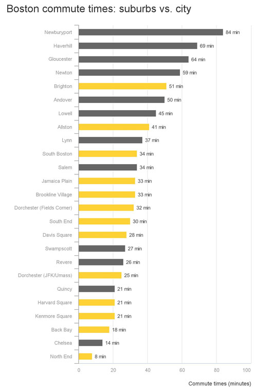
0 Greater Boston Commute Time vs Price per Square Foot

Commute times on public transportation versus diving can vary greatly if you depart at the exact time into Boston.  Commuters that depart early regardless of public or private can reduce their commuting time.  I live west of Boston and ride in on the Pike, if I hit the Weston tolls by 6:05 AM my ride door to door is 26 minutes.  If I hit the tolls by 8:15 I can plan on an hour +/-.

graph of Boston commute times

Credit: NeighborhoodX

According to a Boston.com article, “Constantine Valhouli, the cofounder of NeighborhoodX, a neighborhood-specific reporting and data startup, compiled the commuting information by measuring the time it takes to get from each town to North Station. He found each of the commute times via a Google query between 8:00 a.m. and 9:00 a.m. and used the longest of the available transportation options, to get a more conservative estimate. Hoping to understand the relationship between location and price, Valhouli found there are places in Boston that often get overlooked…Some places he mentioned were Chelsea, which held the second fastest commute time to North Station behind the North End, at 14 minutes, Quincy at 21 minutes, and Revere at 26 minutes. was built between 1802 and 1804 and was designed by Boston’s famous architect, Charles Bulfinch. It is now called St. Stephen’s Church.”

You can read the full article on Boston.com.


0 Map Indicates Walking Time to the Nearest MBTA Station

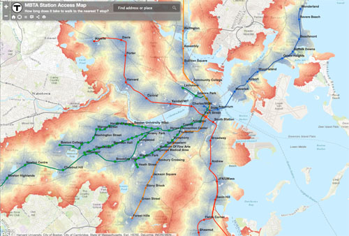
The largest concentration of office space north of New York City is the Boston Financial District.  A frequently asked question is, “what the nearest T line and how far is the walk?” Thanks to Aaron Doucett, we now have an answer.

Boston walking map of MBTA stations

Credit: Doucettmaps

From Boston.com:

[Doucett’s] current creation is a map that MBTA riders can use to visualize the walking distance between their home or office and the nearest MBTA station.

“I wanted to create something that anyone living in Boston or the surrounding cities would find interesting and useful,” Doucett said. “I think this map would also be very helpful for someone looking to move to the area, who is searching for apartments or jobs and wants to estimate their commute.”

Follow this link to view the MBTA walking map.

0 Back Bay Station Air Quality Fixes Prove Costly

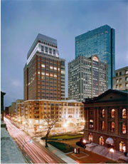
Back Bay office buildings at duskThe cost of clean air is very expensive, but totally worth it.

According to an article on Banker & Tradesman, “The repairs could climb from $800,000 to $6 million…The MBTA commissioned Westwood-based Hatch Mott MacDonald to study the decades-old ventilation system as part of a $32-million station renovation project being led by developer Boston Properties. For years, diesel exhaust from commuter rail locomotives has lingered on station platforms and filtered up to the concourse…MassDOT spokesman Jason Johnson said the MBTA will adopt the report’s recommendation of creating a modeling assessment that would include detailed engineering. The model is expected to be completed by the end of winter.”

You can read additional information on the air quality assessment of Back Bay station on the B&T website.

Related Office Space Listings
Back Back Office Space

0 Seaport Shuttle Service Looks to Reduce Area Traffic

traffic in Boston Seaport

Credit: Boston Globe

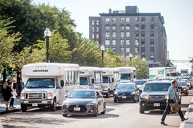
The success of the Seaport/Innovation District has created commuter chaos.  The city leadership is looking at ways to mitigate this by decreasing 20 private bus routs down to just two.  Office landlords have offered shuttle service to and from their buildings to commuter hubs like North and South Stations, which is great, but not with 20 buses making the same route at the same time.

According to the Boston Globe, “Consolidating the shuttles was a key piece in a far-reaching plan, funded by waterfront players, to address the gridlock. The report, made public in January, offered a long list of fixes big and small, from repairing and reopening the old Northern Avenue bridge for vehicular traffic to adding more Hubway bike-sharing stations in the area…Workers would show an ID to hop on board for free, just as they do now. Members of the public wouldn’t typically be allowed, though Peterson said shuttle drivers may wave them through on bad weather days. Eventually, other companies would be invited to join, and trips to the Back Bay and other locations could be considered.”

You can read the full article on the Boston Globe, here.


0 Boston Taxis Launch Smartphone App to Compete with Uber

Boston Taxi

Credit: Boston Business Journal

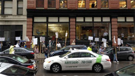
How do you prefer to traverse the city; Uber, Lift or a yellow taxi?  The taxis of the city are trying to level the field by launching their own app.

According to the BBJ, “the app, which can connect with Apple Pay or Google Wallet, has already launched in Philadelphia and New York City. More than 1,400 of the 1,600 licensed taxis in Philadelphia are already equipped with Verifone payment systems for credit card acceptance and are ready for Way2ride…there are currently 1,825 licensed cabs operating in the city of Boston…A Boston taxi industry group spokeswoman said it was too early to tell if the app would be a step in the right direction. Taxi union spokeswoman Donna Blythe-Shaw said she was more concerned with the fact that taxis are still forced to comply with more stringent and often-complex regulations than ride-hailing services such as Uber and Lyft.

You can read the full article on the Boston Business Journal’s website.

0 Waze will Alert Drivers to the most dangerous intersections in Boston

Waze app showing Traffic in Boston

Credit: BBJ

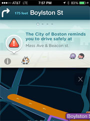
Should your travels to the office take you or your clients through dangerous intersections, turn to Waze to help you in Boston and 4 other cities.

According to the BBJ, “Waze said the app will alert drivers about intersections with a high-collision rates, high-injury rates, vehicle-to-vehicle incidents, vehicle to bike incident and vehicle-pedestrian incidents…Waze will then overlay its crowdsourced incident reports to calculate the intersections or stretches of road that have the highest comparative risk of incidents and injury to drivers and passengers.”

You can read the full article on the Boston Business Journal website.

0 What Does the Commute Cost Boston Drivers?

Do you pick you job based on where you live or do you pick where you live based on your job?

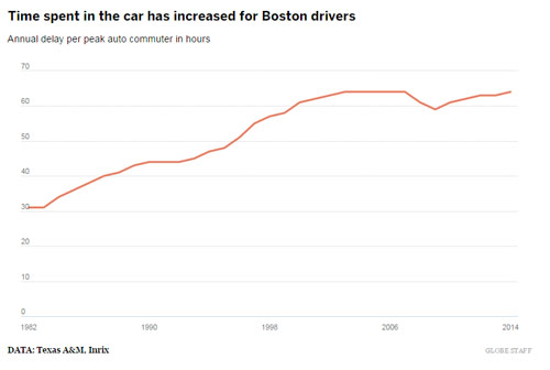
According to estimates from the Boston Globe, “Boston-area drivers spent an extra 64 hours in the car due to traffic in 2014, a new study found. During that time, they burned an extra 30 gallons of gas and also lost time they could have been productive. It added up to an estimated $1,388 lost per driver…Boston ranked as the sixth worst major metropolitan area for traffic congestion.”

boston_commuters_time_in_car

Credit: Boston Globe

You can read the full article on the Boston Globe.

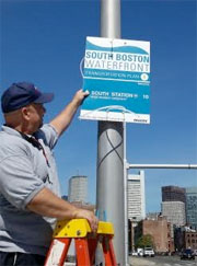
0 Seaport Sports New Wayfinding Signs

Boston Seaport signs

Credit: B&T

I’m sorry, which way to the Seaport/Innovation District?  Let us help you get there.

According to Banker and Tradesman, “New wayfinding signs were installed in Boston’s Seaport District on Friday as part of a pilot program to make the fast-changing neighborhood more navigable to pedestrians and out-of-town visitors. The first phase includes signs designed to help pedestrians find their way from the Boston Convention and Exhibition Center to neighborhood landmarks such as the Fan Pier, Liberty Wharf and South Station.”

You can read more on the new Seaport signage on B&T.