0 Seaplane from Boston Waterfront to NYC

Seaplane planned for Boston harbor

Credit: The Boston Globe

The Boston waterfront will eventually be host to another form of transportation to NYC: Seaplane. Two companies, Tailwind and Cape Air, are lining up for the $1,000 round trip fares.

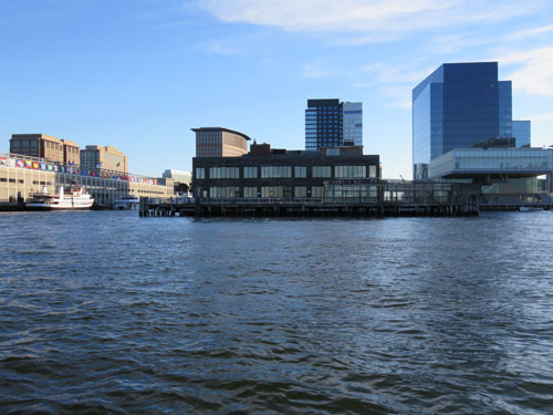
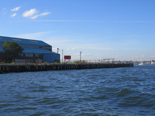
Some expect this service will arrive in Boston Harbor in 2017 and will depart from a pier in the Seaport.

From the Boston Globe:

After at least two years of preparations and behind-the-scenes discussions, the rival companies Tailwind and Cape Air will each test a nine-passenger Cessna Caravan in Boston Harbor this week as they seek Federal Aviation Administration approval to use the harbor as a take-off and landing zone. One factor the agency will be watching: whether the seaplanes can safely navigate the busy airspace next to Logan International Airport, along with a harbor often crowded with boats. If they receive the federal approvals they need, both companies could launch service within a year.

“You’re really going to be able to . . . get on an airplane at 8 a.m., be at a morning meeting in New York, and turn around and be back by lunchtime,” Wolf said. “We think demand is going to be strong.”

0 South Boston Marine Industrial Park Appears Marked for Development

The view of Boston from the water is one of the most photographed in the city. The South Boston industrial area does not get the same airtime as Rowes Wharf or the skyline of the Financial District.  Rest assured, changes are coming as our city continues to expand.

The Boston Globe reports on “the biggest proposed changes that could emerge in the coming months: expanding what the city considers “marine” to cram more industrial uses on the remaining undeveloped sites. The updated plan could bring buildings that are taller or have bigger footprints. It could also provide for more lab space and new restaurants to serve the park’s estimated 3,500 workers. A second parking garage could be in the works, and improvements to make it easier for boats to pull up.”

This picture was taken of the former Anthony's Pier 4

This picture was taken of the former Anthony’s Pier 4

This picture was taken at the end of the North Jetty off of Fid Kennedy Avenue

This picture was taken at the end of the North Jetty off of Fid Kennedy Avenue

0 Seaport Sports New Wayfinding Signs

Boston Seaport signs

Credit: B&T

I’m sorry, which way to the Seaport/Innovation District?  Let us help you get there.

According to Banker and Tradesman, “New wayfinding signs were installed in Boston’s Seaport District on Friday as part of a pilot program to make the fast-changing neighborhood more navigable to pedestrians and out-of-town visitors. The first phase includes signs designed to help pedestrians find their way from the Boston Convention and Exhibition Center to neighborhood landmarks such as the Fan Pier, Liberty Wharf and South Station.”

You can read more on the new Seaport signage on B&T.

0 Northern Avenue Bridge will be Restored for Motor Vehicle Traffic

northern avg bridge leads to seaport office buildings in Boston

Credit: B&T

The Northern Avenue bridge built in 1908 is recommended to get another lease on life.  The bridge is one of the last remaining swing bridges in New England and is an engineering marvel to watch when it’s in motion.

The bridge was not only designed for pedestrians and cars, but also the Union Freight Railroad.

A study on the Seaport, referenced in Banker&Tradesman, cites the following:

The overall volume of commutes into the Seaport will increase 63 percent by 2035…The study committee’s consensus: restoring the three-lane bridge, with one lane dedicated for motor vehicles. Pedestrian and bicycle access also would be preserved.

“There was some concern in the pedestrian and bicycling community about opening it up to traffic,” said Rick Dimino, CEO of Boston-based planning organization A Better City Inc. “But at the end of the day, there was pretty substantial support that the bridge needs to be opened up to traffic again.”


0 Defining Boston’s Seaport District

Seaport office space in boston

Credit: BBJ

The Seaport, formerly known as the South Boston Waterfront has not only evolved, but arrived.  Interestingly it is not as clearly defined geographically as one might think.  One border is the Fort Point Channel and another is Boston Harbor.  Beyond that, it is up to some interpretation.

According to CoStar, the border continues to West 2nd Street and East 2nd Street.  The core of the Seaport in my opinion consists of: Summer Street, Congress Street and Seaport Boulevard and the various intersecting streets.  The Boston Design Center, Convention Center and Wormwood Street would also be included.

The Boston Business Journal quantifies the growth, noting, the Seaport District “already has a population bigger than Beacon Hill’s, and more radical change is on the short-term horizon. Some of the region’s most experienced developers are pushing forward projects that within three years should create more than 2,500 housing units. City planners see another doubling in housing stock, to 10,000 units, by 2030.

0 UberBoat to Provide Limited Water Service in Boston

Boston boat transportation

Credit: Uber

Need a ride to the airport or a harbor island from the Financial District?  Walk toward the waterfront at get within .25 mile of the water and open Uber.  This is pilot program only from June 4th to June 15th.

Boston Magazine notes that “in order to access the UberBOAT option, users have to be within a quarter-mile of the harbor. When they are close enough, the app will then display an UberBOAT icon on the screen. From there, people can simply “place a pin” on a map , indicating where they want to be picked up near the docks, and hit the “Request” button. Soon after, a boat will appear. “Once your request has been accepted, the captain will give you a call to confirm your location and provide additional details on reaching the dock,” the company said.”

Jump over to Boston Magazine to read the complete article and to view an interactive map of the water taxi operation area.

0 Boston Waterfront: $20M Upgrade Proposed

map of boston waterfront upgrades

Credit: Bisnow.com

This is terrific news and should be implemented immediately.  Public access to our natural beauty is imperative to the City’s continued growth in the years to come.  Not too far back, the suppression of the Central Artery bridged many areas of our city and created the Greenway.

From Bisnow:

“The City’s new proposal to spend $20M to upgrade 40 acres along the waterfront from the North End to Fort Point with open space, cultural attractions, and entertainment (fingers crossed for Ferris wheel) will elevate the rapidly changing district, BRA deputy director for waterfront planning Richard McGuiness tells Bisnow. The aim: upgrade the border of “our greatest natural resource: Boston Harbor.”

The complete Bisnow article is available on its website, here

0 MassDOT: The Development Prevention Team?

Central Artery in BostonIf history is any clue into the future, it would be safe to assume that MassDOT is on the development prevention team. Many of these projects, such as this, provide a necessary “Bridge” between two neighborhoods of our city.  For example, the suppression of the Central Artery and the creating of the Greenway links the North End and Waterfront with the Financial District.