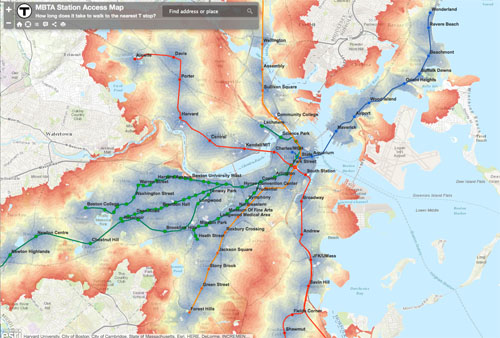
The largest concentration of office space north of New York City is the Boston Financial District. A frequently asked question is, “what the nearest T line and how far is the walk?” Thanks to Aaron Doucett, we now have an answer.
Credit: Doucettmaps
From Boston.com:
[Doucett’s] current creation is a map that MBTA riders can use to visualize the walking distance between their home or office and the nearest MBTA station.
“I wanted to create something that anyone living in Boston or the surrounding cities would find interesting and useful,” Doucett said. “I think this map would also be very helpful for someone looking to move to the area, who is searching for apartments or jobs and wants to estimate their commute.”
Follow this link to view the MBTA walking map.