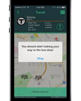
What’s the fastest way to get there? I was leaving my office on Boylston Street Last week headed to the corner of High and Federal. My route was my standard one: hop on the T at Back Bay and head to Park Street then walk through Downtown Crossing down Summer to High.
As I walked across Exeter Street at Boylston Street, I noticed a motorcycle rider on a Ducati, felt the warm day air, and thought, Spring is burgeoning. As my trip progressed, I walked in front of 100 Summer Street and noticed the same rider on the same bike. Was my way quicker or did the rider stop for a coffee at Flat Black? Not sure, but I was rather impressed that the T scored the same speed as a motorcycle.
If you’re unsure of the best route or means for a particular trip, check out RideScout, and see what’s your quickest path to your Boston destination.
The BBJ describes RideScout’s functionality, which is now available in Boston and Cambridge:
“The app aggregates ground transportation services including public transit, private options and social ride-share that allows users to search and compare options in real-time..,Users of the app can find and connect with Zipcars, Hailo taxis, Hubway bike share, MBTA bus and rail services.”
Additional details are available on the Boson Business Journal.

